|
A nautical map is a graphic representation of a maritime area. Nautical maps present you information in a similar way to that of a land map. The information displayed on a nautical map may show depths of water and heights of land, natural features of the seabed, details of the coastline, navigational hazards, locations of natural and man made aids to help guide navigation. These maps are available in both a traditional style as a printed folding map but more often seen in software on-board ships in the modern day.
|
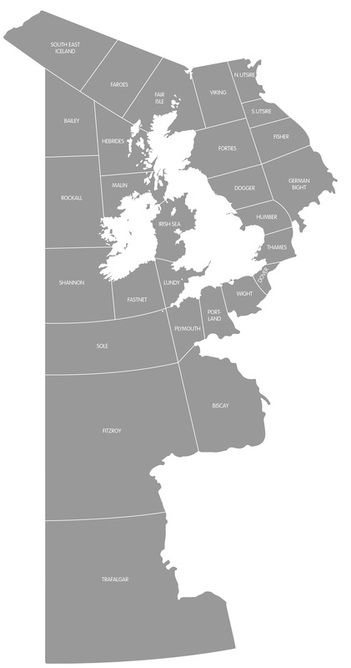
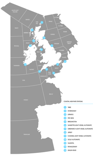
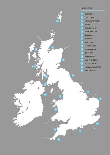
The maps within the Shipping Forecast are irregular in comparison to any other form of mapping. The grid style map behind the Shipping Forecasts was never designed, starting out as geometric plotting’s based on surrounding land to initially define area’s it has slowly evolved from 13 sea areas to 31. The areas as of today have been more accurately amended to reflect truer readings and weather conditions to produce more accurate broadcasts. Within the mapping there are three key pieces of information, the zoning of sea areas, inshore water zones covering up to 12 miles out to sea and coastal weather stations. Being the main visual element for the landlubber it’s become a symbol of a clockwise journey that the Shipping Forecast transports you through.
|
|
The forecasts are made reported from three main areas. In the first you are given a general synopsis which puts the forecasts into mapped areas (as seen right). This tells of wind direction, strength, precipitation, visibility and icing. The second reading of the forecasts is the coastal station reports or 'general situation' report which give details of sea level pressures and tendencies, map as seen below, right. The third and final part of the forecasts covers the inshore waters of the UK, divided into area's (covering up to 12 miles out from the coast).
In the forecast, areas are named in a roughly clockwise direction always starting with viking. The forecast for Trafalgar is found only in the 0048 forecast - other forecasts do, however, report when there are warnings of gales in Trafalgar. The maps I created here take the idea of the forecast and the sea being the focus, acting as how we're used to seeing mapped mainland, in block colour. They are the focus and therefore make the maps more meaningful. I opted for the a simple colour palette, and brought in a contrasting blue. This keeps it fresh as well as relating back to the nautical theme this shipping entails. |
|
|
|
|
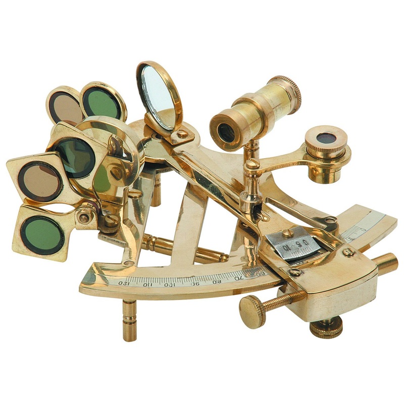
The sextant is an instrument used to measure the angle between any two visible objects. Its primary use is to determine the angle between a celestial object and the horizon which is known as the object's altitude.
Using this measurement is known as sighting the object and it is an essential part of navigating in relation to the sky. The angle, and the time when it was measured, can be used to calculate a position line on a nautical or aeronautical chart. Common uses of the sextant include sighting the sun at solar noon to find one's latitude. Sighting the height of a landmark can give a measure of distance off and, held horizontally, a sextant can measure angles between objects for a position on a chart. A sextant can also be used to measure the lunar distance between the moon and another celestial object in order to determine Greenwich Mean Time which is important because it can then be used to determine the longitude. |
IMAGES ARE NOT MY OWN. NO COPYRIGHT INTENDED.
|
|
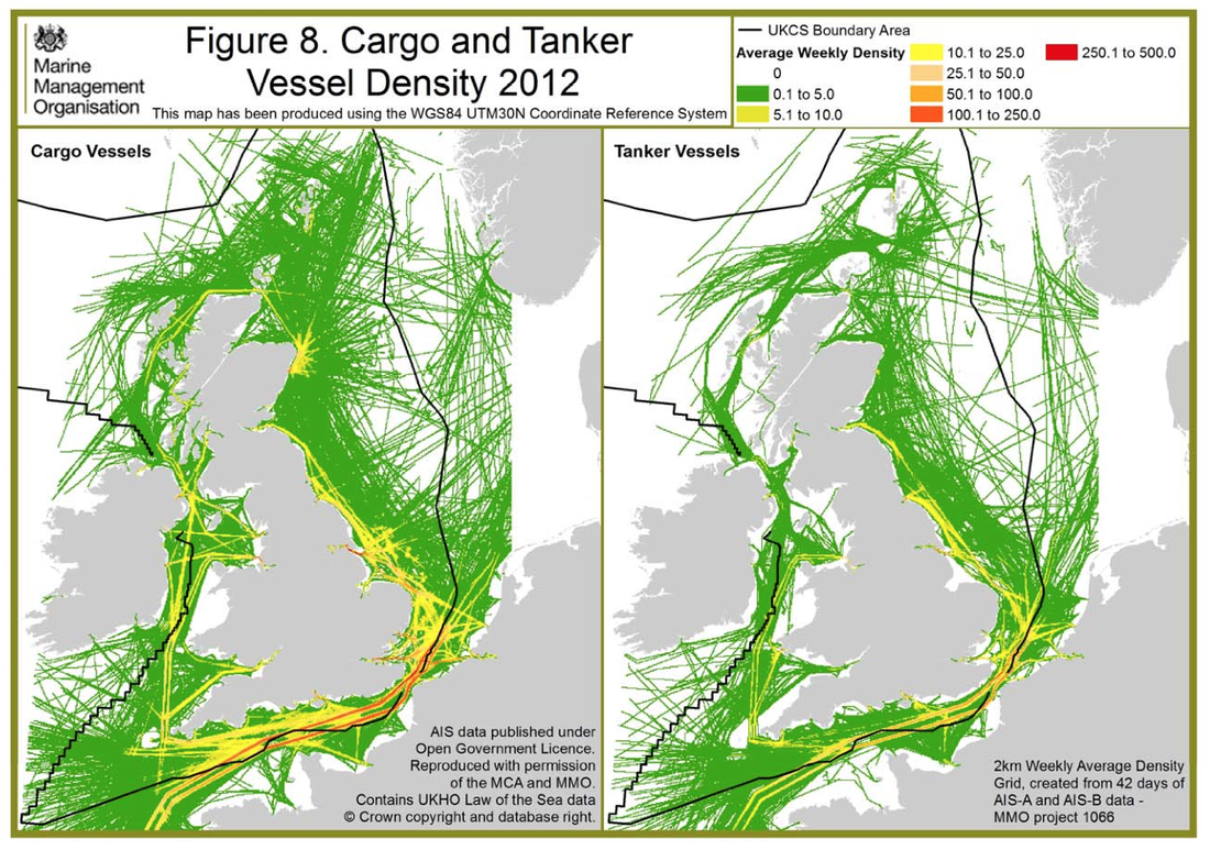
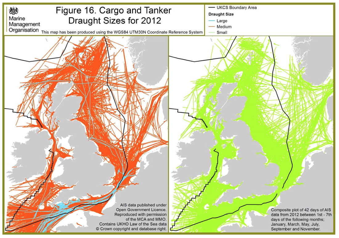
Below are two interesting articles on the crossings from the UK via sea showing statistics on what, why and mapped with where. Shown right are six already mapped out info graphics on the usage of the channel over a week for different purposes.
These maps tell you that the sea, for transport is used predominantly for cargo and tanker ships. Of which are mostly medium sized cargo tankers. There are a smaller percentage of Large Cargo ships on the south coasts in the British Channel crossing mainly. |
      |
|
|
|
|
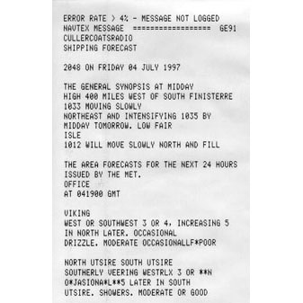
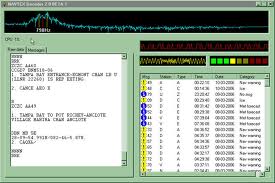
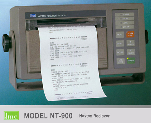
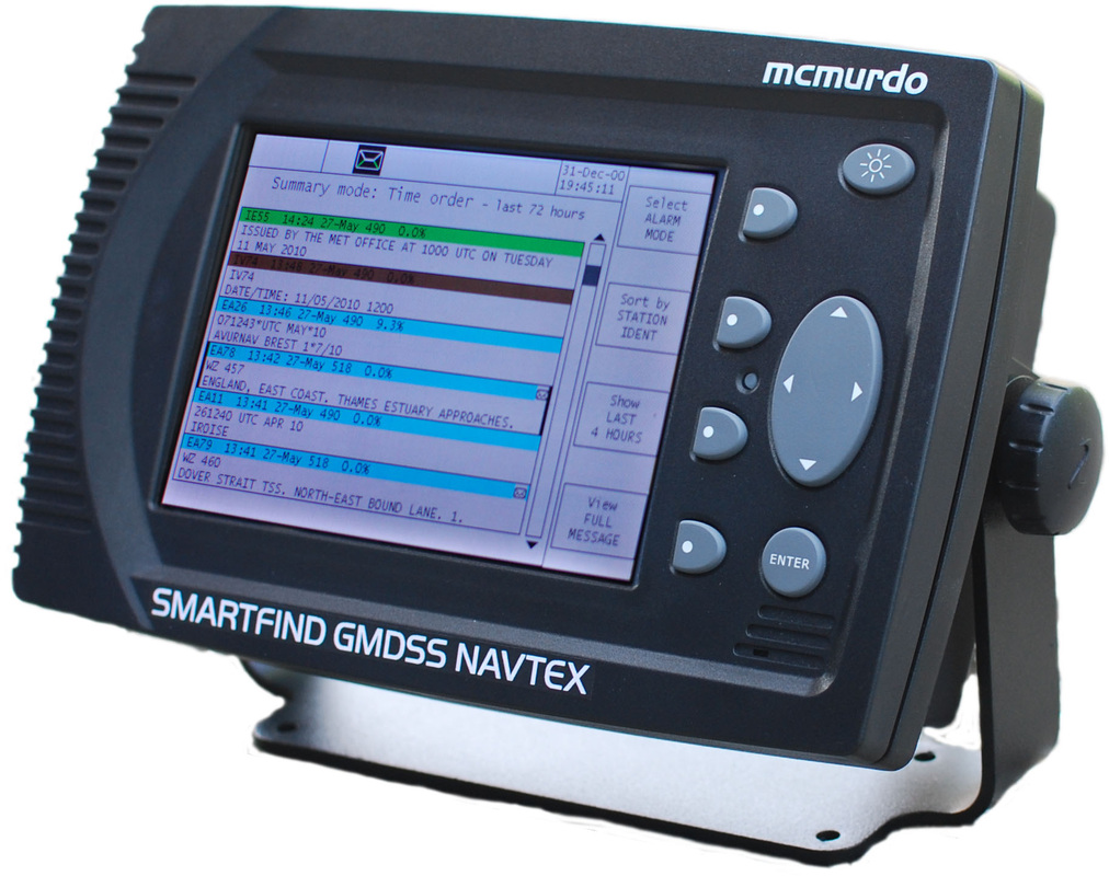
Navtex is an international automated direct-printing service delivering navigational and meteorological warnings and forecasts, as well as urgent marine safety information to ships. It was developed to provide a low cost, simple, and automated means of receiving this information aboard ships at sea within approximately 200 nautical miles off the shore.
It has taken over from the likes of the shipping forecasts, to which Navtex receives and prints also, due its more precise and accurate readings invalidating the shipping forecast news. Navtex updates are a lot more regular which means the information is more accurate, being vital. Navtex operates in a code of letters which portrays quick and simple messages, understood to those trained, alike that of the shipping forecasts. It is printed in the following order made up of the following letters: Time of origin: The time of the transmission of the message. Message text: The full text of the message follows. End of message: The end of the message is asserted when the characters "NNNN" are received. |
A: Navigational warnings B: Meteorological warnings C: Ice reports D: Search & rescue information, and pirate warnings E: Meteorological forecasts F: Pilot service messages G: AIS messages H: LORAN messages I: Not used J: SATNAV messages K: Other electronic navaid messages L: Navigational warnings (additional to letter A) T: Test transmissions (UK only) V: Notice to fishermen (U.S. only) W: Environmental (U.S. only) X: Special services - from IMO NAVTEX Panel Y: Special services - from IMO NAVTEX Panel Z: No message on hand |